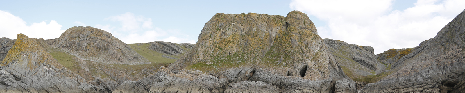
Spring Squill Hole
Location
- Site Name
- Spring Squill Hole
- Parish
- Rhossili
- Gower Region
- South-West Gower
- Latitude
- 0
- Longitude
- 0
- X
- Y
- Z
- 0
- OSNG
Identification
- Position
- Entrance
- Entrance Height (m)
- 0
- Entrance Width (m)
- 0
- Type of Cave
- Archaeological
- Access
Description
Discoveries
- Archaeology
- Flint Tools, Flint Debitage
- Time Period-Culture
- Neolithic
- Fauna
- Red Deer - Cervus elaphus, Wild Pig - Sus scrofa
- Notes
Gallery
Bibliography
- 1902014 Spring Squill Hole 1 harvard1 50 creator asc year 1 1 1 2180 https://www.gowerbonecaves.org.uk/wp-content/plugins/zotpress/%7B%22status%22%3A%22success%22%2C%22updateneeded%22%3Afalse%2C%22instance%22%3Afalse%2C%22meta%22%3A%7B%22request_last%22%3A0%2C%22request_next%22%3A0%2C%22used_cache%22%3Atrue%7D%2C%22data%22%3A%5B%7B%22key%22%3A%22ATD6NZIT%22%2C%22library%22%3A%7B%22id%22%3A1902014%7D%2C%22meta%22%3A%7B%22creatorSummary%22%3A%22Davies%22%2C%22parsedDate%22%3A%221985%22%2C%22numChildren%22%3A0%7D%2C%22bib%22%3A%22%26lt%3Bdiv%20class%3D%26quot%3Bcsl-bib-body%26quot%3B%20style%3D%26quot%3Bline-height%3A%201.35%3B%20%26quot%3B%26gt%3B%5Cn%20%20%26lt%3Bdiv%20class%3D%26quot%3Bcsl-entry%26quot%3B%26gt%3BDavies%2C%20M.%20%281985%29%20%26%23x201C%3BSpurge%20Hole%2C%26%23x201D%3B%20%26lt%3Bi%26gt%3BWilliam%20Pengelly%20Cave%20Studies%20Trust%20Newsletter%26lt%3B%5C%2Fi%26gt%3B%2C%20pp.%201%26%23x2013%3B4.%26lt%3B%5C%2Fdiv%26gt%3B%5Cn%26lt%3B%5C%2Fdiv%26gt%3B%22%2C%22data%22%3A%7B%22itemType%22%3A%22magazineArticle%22%2C%22title%22%3A%22Spurge%20Hole%22%2C%22creators%22%3A%5B%7B%22creatorType%22%3A%22author%22%2C%22firstName%22%3A%22Melvyn%22%2C%22lastName%22%3A%22Davies%22%7D%5D%2C%22abstractNote%22%3A%22%22%2C%22date%22%3A%221985%22%2C%22ISSN%22%3A%22%22%2C%22DOI%22%3A%22%22%2C%22citationKey%22%3A%22%22%2C%22url%22%3A%22%22%2C%22language%22%3A%22%22%2C%22collections%22%3A%5B%5D%2C%22dateModified%22%3A%222021-12-30T16%3A32%3A10Z%22%7D%7D%2C%7B%22key%22%3A%22DZC4CWHK%22%2C%22library%22%3A%7B%22id%22%3A1902014%7D%2C%22meta%22%3A%7B%22creatorSummary%22%3A%22Plunkett-Dillon%20and%20Latham%22%2C%22parsedDate%22%3A%221987%22%2C%22numChildren%22%3A0%7D%2C%22bib%22%3A%22%26lt%3Bdiv%20class%3D%26quot%3Bcsl-bib-body%26quot%3B%20style%3D%26quot%3Bline-height%3A%201.35%3B%20%26quot%3B%26gt%3B%5Cn%20%20%26lt%3Bdiv%20class%3D%26quot%3Bcsl-entry%26quot%3B%26gt%3BPlunkett-Dillon%2C%20E.%20and%20Latham%2C%20J.%20%281987%29%20%26lt%3Bi%26gt%3BThe%20National%20Trust%20Archaeological%20Survey%3A%20Pennard%20Cliffs%20and%20Bishopston%20Valley%26lt%3B%5C%2Fi%26gt%3B.%20The%20National%20Trust.%26lt%3B%5C%2Fdiv%26gt%3B%5Cn%26lt%3B%5C%2Fdiv%26gt%3B%22%2C%22data%22%3A%7B%22itemType%22%3A%22report%22%2C%22title%22%3A%22The%20National%20Trust%20Archaeological%20Survey%3A%20Pennard%20Cliffs%20and%20Bishopston%20Valley%22%2C%22creators%22%3A%5B%7B%22creatorType%22%3A%22author%22%2C%22firstName%22%3A%22E%22%2C%22lastName%22%3A%22Plunkett-Dillon%22%7D%2C%7B%22creatorType%22%3A%22author%22%2C%22firstName%22%3A%22J%22%2C%22lastName%22%3A%22Latham%22%7D%5D%2C%22abstractNote%22%3A%22%22%2C%22reportNumber%22%3A%22%22%2C%22reportType%22%3A%22%22%2C%22institution%22%3A%22The%20National%20Trust%22%2C%22date%22%3A%221987%22%2C%22DOI%22%3A%22%22%2C%22ISBN%22%3A%22%22%2C%22citationKey%22%3A%22%22%2C%22url%22%3A%22%22%2C%22ISSN%22%3A%22%22%2C%22language%22%3A%22%22%2C%22collections%22%3A%5B%5D%2C%22dateModified%22%3A%222021-12-30T16%3A32%3A10Z%22%7D%7D%2C%7B%22key%22%3A%22MKM4JF82%22%2C%22library%22%3A%7B%22id%22%3A1902014%7D%2C%22meta%22%3A%7B%22creatorSummary%22%3A%22Poucher%22%2C%22parsedDate%22%3A%222002%22%2C%22numChildren%22%3A0%7D%2C%22bib%22%3A%22%26lt%3Bdiv%20class%3D%26quot%3Bcsl-bib-body%26quot%3B%20style%3D%26quot%3Bline-height%3A%201.35%3B%20%26quot%3B%26gt%3B%5Cn%20%20%26lt%3Bdiv%20class%3D%26quot%3Bcsl-entry%26quot%3B%26gt%3BPoucher%2C%20P.%20%282002%29%20%26lt%3Bi%26gt%3BThe%20National%20Trust%20Archaeological%20Survey%3A%20Pennard%20and%20Bishopston%26lt%3B%5C%2Fi%26gt%3B.%20The%20National%20Trust.%26lt%3B%5C%2Fdiv%26gt%3B%5Cn%26lt%3B%5C%2Fdiv%26gt%3B%22%2C%22data%22%3A%7B%22itemType%22%3A%22report%22%2C%22title%22%3A%22The%20National%20Trust%20Archaeological%20Survey%3A%20Pennard%20and%20Bishopston%22%2C%22creators%22%3A%5B%7B%22creatorType%22%3A%22author%22%2C%22firstName%22%3A%22P%22%2C%22lastName%22%3A%22Poucher%22%7D%5D%2C%22abstractNote%22%3A%22%22%2C%22reportNumber%22%3A%22%22%2C%22reportType%22%3A%22%22%2C%22institution%22%3A%22The%20National%20Trust%22%2C%22date%22%3A%222002%22%2C%22DOI%22%3A%22%22%2C%22ISBN%22%3A%22%22%2C%22citationKey%22%3A%22%22%2C%22url%22%3A%22%22%2C%22ISSN%22%3A%22%22%2C%22language%22%3A%22%22%2C%22collections%22%3A%5B%5D%2C%22dateModified%22%3A%222021-12-30T16%3A32%3A10Z%22%7D%7D%2C%7B%22key%22%3A%22R46FAD8S%22%2C%22library%22%3A%7B%22id%22%3A1902014%7D%2C%22meta%22%3A%7B%22numChildren%22%3A1%7D%2C%22bib%22%3A%22%26lt%3Bdiv%20class%3D%26quot%3Bcsl-bib-body%26quot%3B%20style%3D%26quot%3Bline-height%3A%201.35%3B%20%26quot%3B%26gt%3B%5Cn%20%20%26lt%3Bdiv%20class%3D%26quot%3Bcsl-entry%26quot%3B%26gt%3B%26lt%3Bi%26gt%3BMNA132095%20%7C%20Spring%20Squill%20Cave%20-%20Yellow%20Top%2C%20Paviland%20Cliff%2C%20South%20Gower%20Coastal%20Properties%26lt%3B%5C%2Fi%26gt%3B%20%28no%20date%29%20%26lt%3Bi%26gt%3BNational%20Trust%20Heritage%20Records%26lt%3B%5C%2Fi%26gt%3B.%20Available%20at%3A%20%26lt%3Ba%20class%3D%26%23039%3Bzp-ItemURL%26%23039%3B%20target%3D%26%23039%3B_blank%26%23039%3B%20href%3D%26%23039%3Bhttps%3A%5C%2F%5C%2Fheritagerecords.nationaltrust.org.uk%5C%2FHBSMR%5C%2FMonRecord.aspx%3Fuid%3DMNA132095%26%23039%3B%26gt%3Bhttps%3A%5C%2F%5C%2Fheritagerecords.nationaltrust.org.uk%5C%2FHBSMR%5C%2FMonRecord.aspx%3Fuid%3DMNA132095%26lt%3B%5C%2Fa%26gt%3B%20%28Accessed%3A%20July%2019%2C%202019%29.%26lt%3B%5C%2Fdiv%26gt%3B%5Cn%26lt%3B%5C%2Fdiv%26gt%3B%22%2C%22data%22%3A%7B%22itemType%22%3A%22webpage%22%2C%22title%22%3A%22MNA132095%20%7C%20Spring%20Squill%20Cave%20-%20Yellow%20Top%2C%20Paviland%20Cliff%2C%20South%20Gower%20Coastal%20Properties%22%2C%22creators%22%3A%5B%5D%2C%22abstractNote%22%3A%22A%20small%20cave%20on%20the%20side%20of%20a%20dry%20valley%20east%20of%20Foxhole%20Slade%20approached%20only%20by%20a%20difficult%20cliff%20traverse.%20Excavated%20by%20Mel%20Davies%20in%20May%201985%20%28Davies%201985%20p5-9%29%20who%20found%20a%20pig%20humerus%20and%20a%20flint%20scraper%20underneath%20layers%20of%20modern%20animal%20bones.%20Artifacts%20now%20in%20the%20possession%20of%20Mel%20Davies.%22%2C%22date%22%3A%22%22%2C%22DOI%22%3A%22%22%2C%22citationKey%22%3A%22%22%2C%22url%22%3A%22https%3A%5C%2F%5C%2Fheritagerecords.nationaltrust.org.uk%5C%2FHBSMR%5C%2FMonRecord.aspx%3Fuid%3DMNA132095%22%2C%22language%22%3A%22en%22%2C%22collections%22%3A%5B%5D%2C%22dateModified%22%3A%222019-07-19T10%3A28%3A46Z%22%7D%7D%5D%7DDavies, M. (1985) “Spurge Hole,” William Pengelly Cave Studies Trust Newsletter, pp. 1–4.Plunkett-Dillon, E. and Latham, J. (1987) The National Trust Archaeological Survey: Pennard Cliffs and Bishopston Valley. The National Trust.Poucher, P. (2002) The National Trust Archaeological Survey: Pennard and Bishopston. The National Trust.MNA132095 | Spring Squill Cave - Yellow Top, Paviland Cliff, South Gower Coastal Properties (no date) National Trust Heritage Records. Available at: https://heritagerecords.nationaltrust.org.uk/HBSMR/MonRecord.aspx?uid=MNA132095 (Accessed: July 19, 2019).